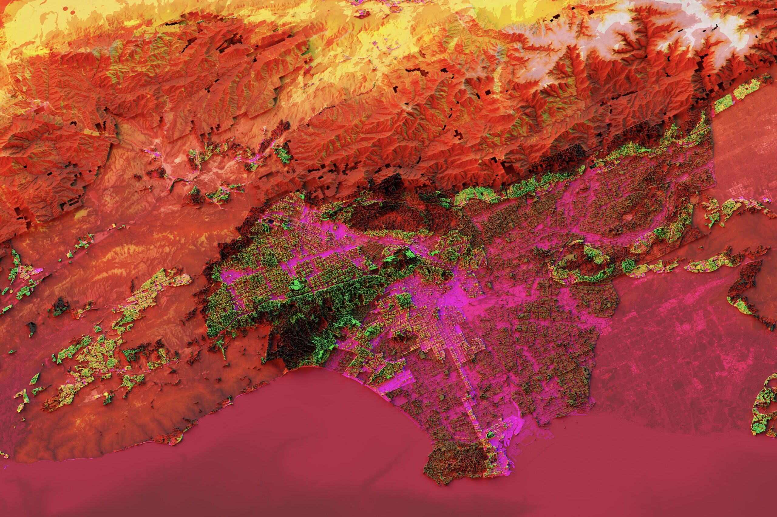
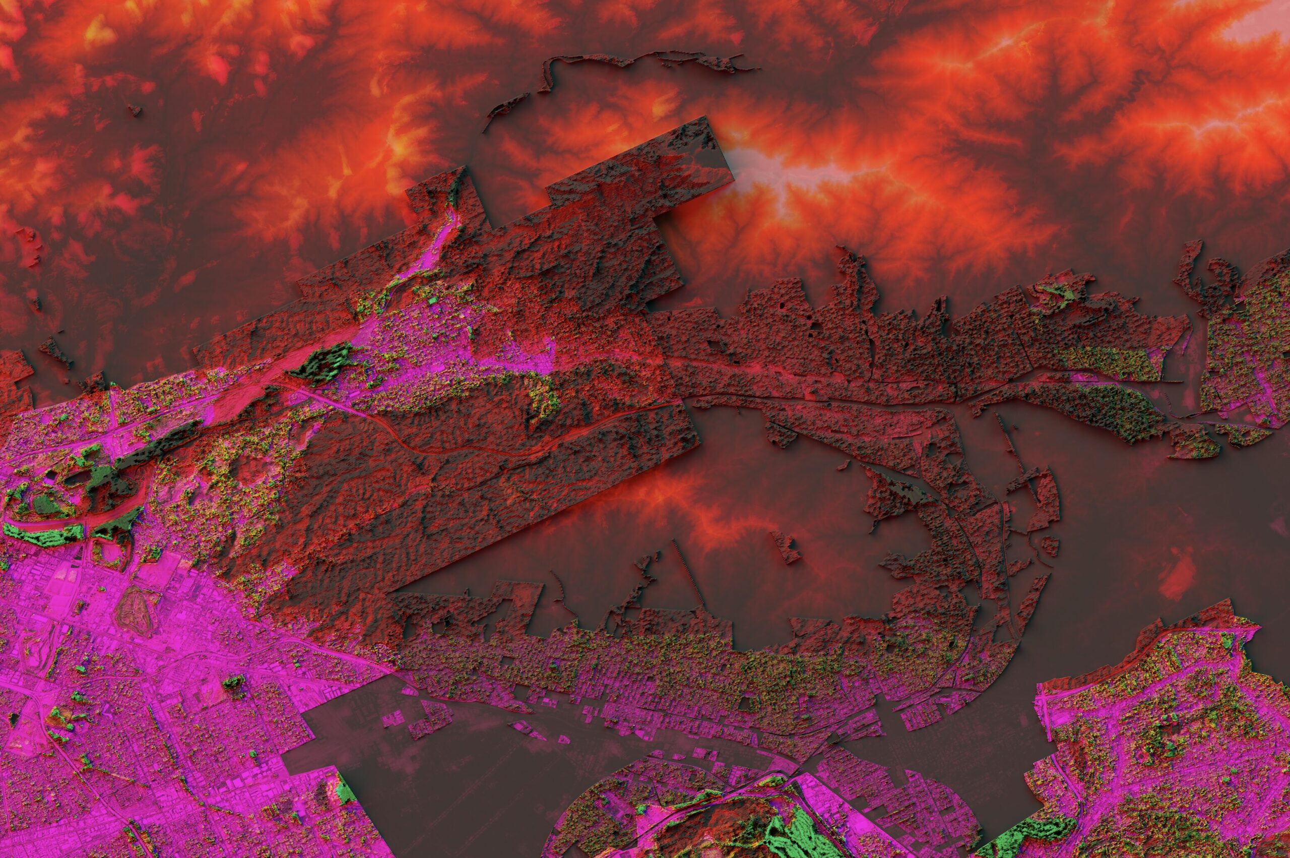
The Xenocartography project develops an experimental approach to geographic visualization using remotely sensed earth observation data. The project explores how satellite and airborne sensing systems— designed to register atmospheric, terrestrial, and oceanic processes across multiple spectral wavelengths— can be retooled for mapping the spatial forms and processes of alienation under modern capitalism. “Xenocartography” proposes a kind of alien surface mapping (xeno/carto/graphy): Rather than treating mapping as alienation— maps as ideology, maps as erasure, mapping as abstraction— the project treats mapping as an indexical mode and medium for representing alienation as a constitutive feature of planetary environmental data.
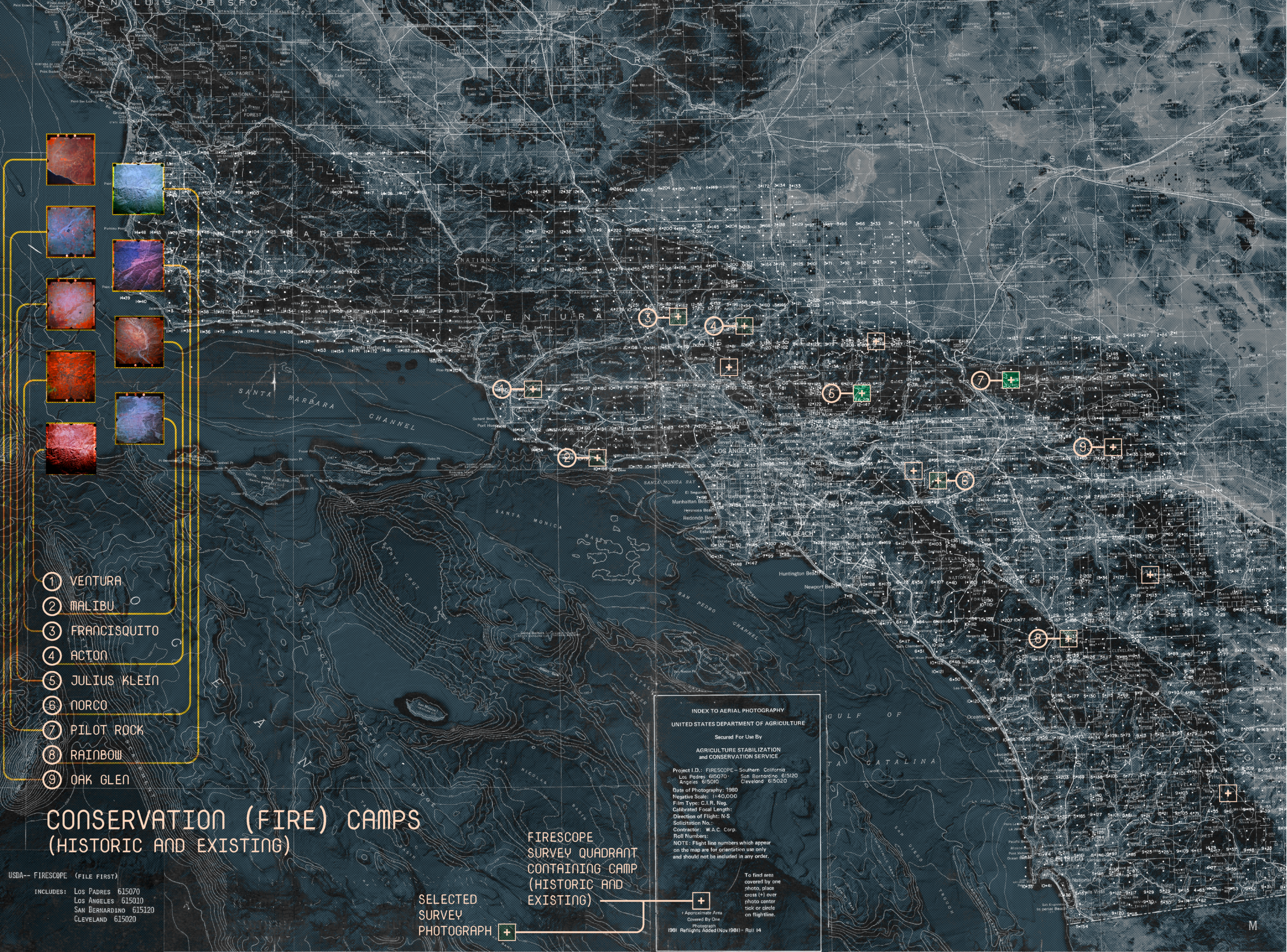
The first area of exploration extends prior research and visualization undertaken by UTL Senior Research Associate Grga Bašić on the Backfire project, in collaboration with the Fondation Cartier in Paris. Xenocartography investigates how we might remap large-scale wildfire as a socioenvironmental formation indexing the climatological longue durée of settler colonial land governance, racialized labor, fire suppression regimes, and fossil-fuel intensive capitalist territorial expansion. The project explores how megafires materialize combustible social relations in the entanglement of degraded fire ecologies, infrastructural and real estate development, and extractive land-use patterns across “mediterranean” geographies in California, the Iberian Peninsula, Chile, and Australia.